This is a concept for two streetcar loops uptown, a red one and a blue one on the maps below. They would share track and stops where both colors are present.
Both loops would have streetcars going in both directions, clockwise and counterclockwise. Most streets would have a pair of tracks on them (except in Calhoun/McMillan area where the tracks split onto one way streets, as shown with arrows on maps below, but still act as part of a bi-directional loop.) The loops are not one-way loops. These loops would not work as one-way loops, because the return trip on a one way loop from a certain point could potentially take a lot longer than the trip there, or vice versa. That means a one-way loop would not be convenient for people to use.
A loop track, even a bi-directional loop, would not provide the most direct connection from a particular point to the opposite end of the loop, but it would provide access between adjacent areas or nodes of activity. And it would provide a transit option in an area that is dense and getting denser with student housing.
McMillan St. would have to be converted into a two way street east of Auburn Avenue for these routes to work.
A separate maintenance facility/rail yard would have to be created somewhere along one of the loops or just off of it.
I created several maps, all of which have tradeoffs regarding cost, travel time, coverage, and implementation difficulty to be considered.
Click to enlarge any map.
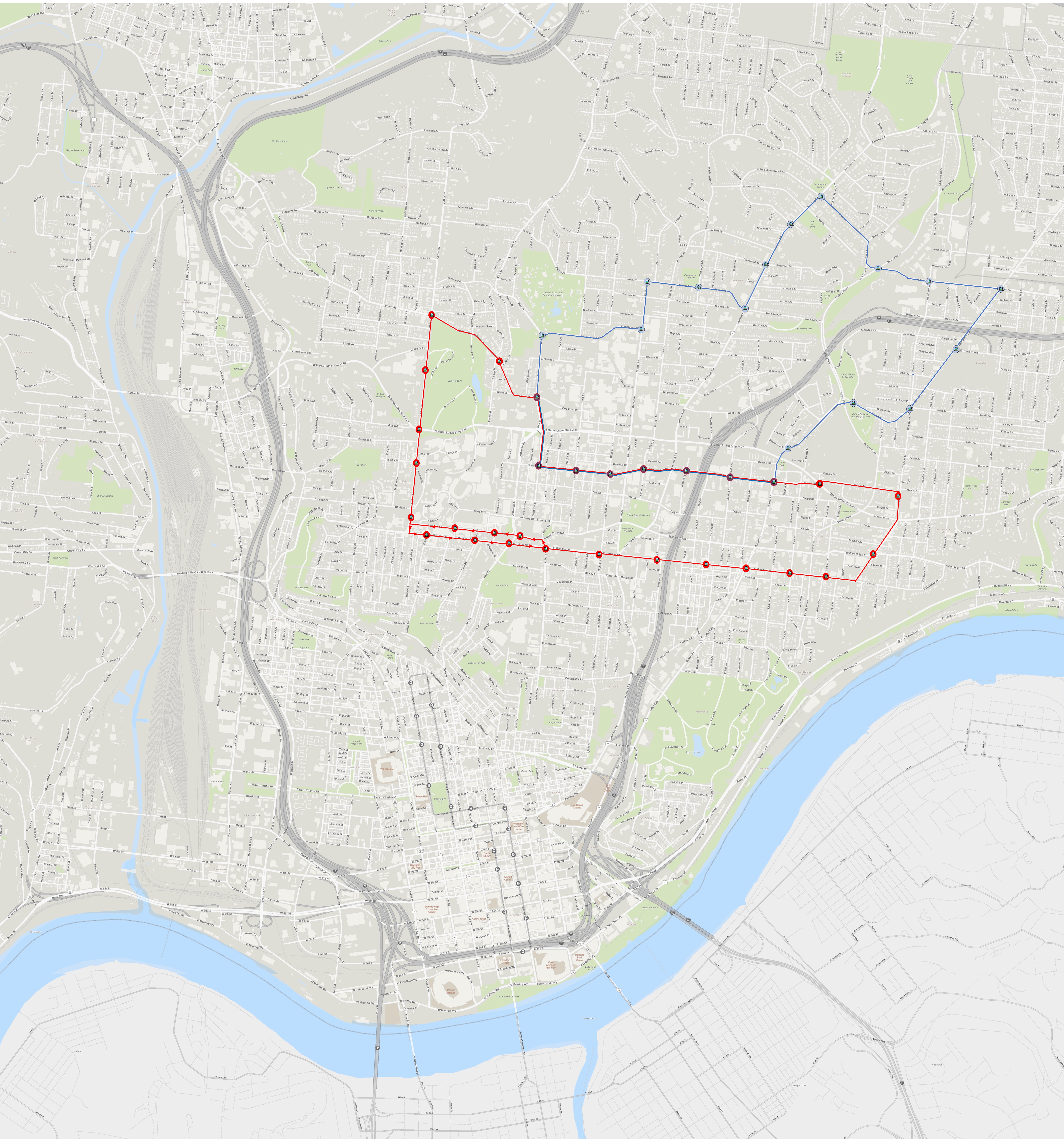
Map Number 1 below shows a wide red loop extending from UC and Clifton Avenue to East Walnut Hills along the University/Lincoln and McMillan corridors. Meanwhile, the blue loop visits the zoo, hospitals and Xavier University using Reading Road and Dana Avenue, before using Montgomery/Gilbert to get back to University/Lincoln to share track with the northern edge of the red loop.
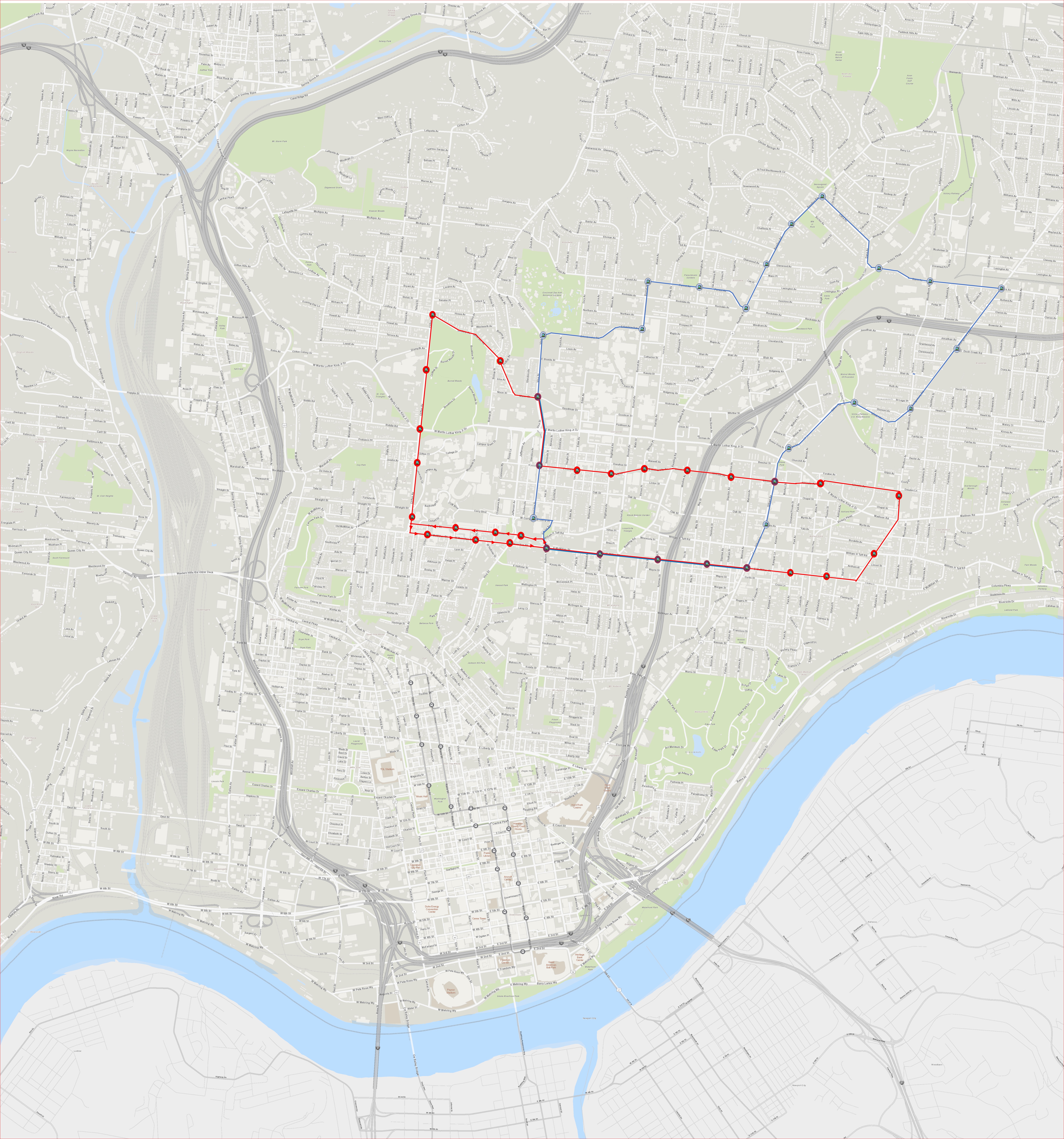
Map Number 2 shows the same loops but the blue loop uses Short Vine and Gilbert to get down to McMillan to share track with the southern edge of the red loop.
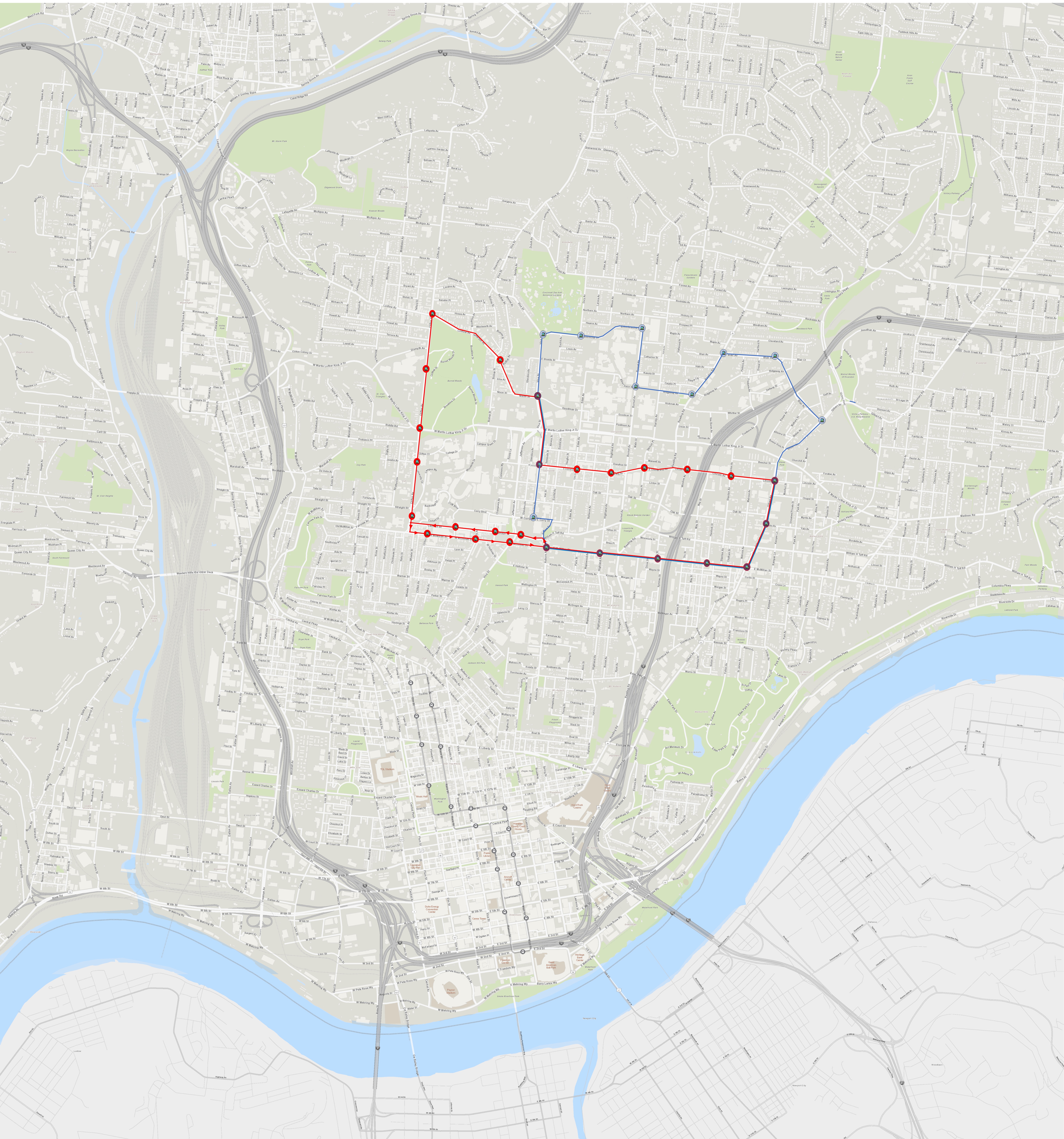
Map Number 3 shrinks the blue loop as Xavier University is no longer served. It travels through the UC Health campus near the location of a planned transit center and uses Ridgeway (which would have to be expanded to accommodate) to get to Reading. It uses Blair Avenue to get to Gilbert. Then, it shares track on McMillan with the southern edge of the red loop.

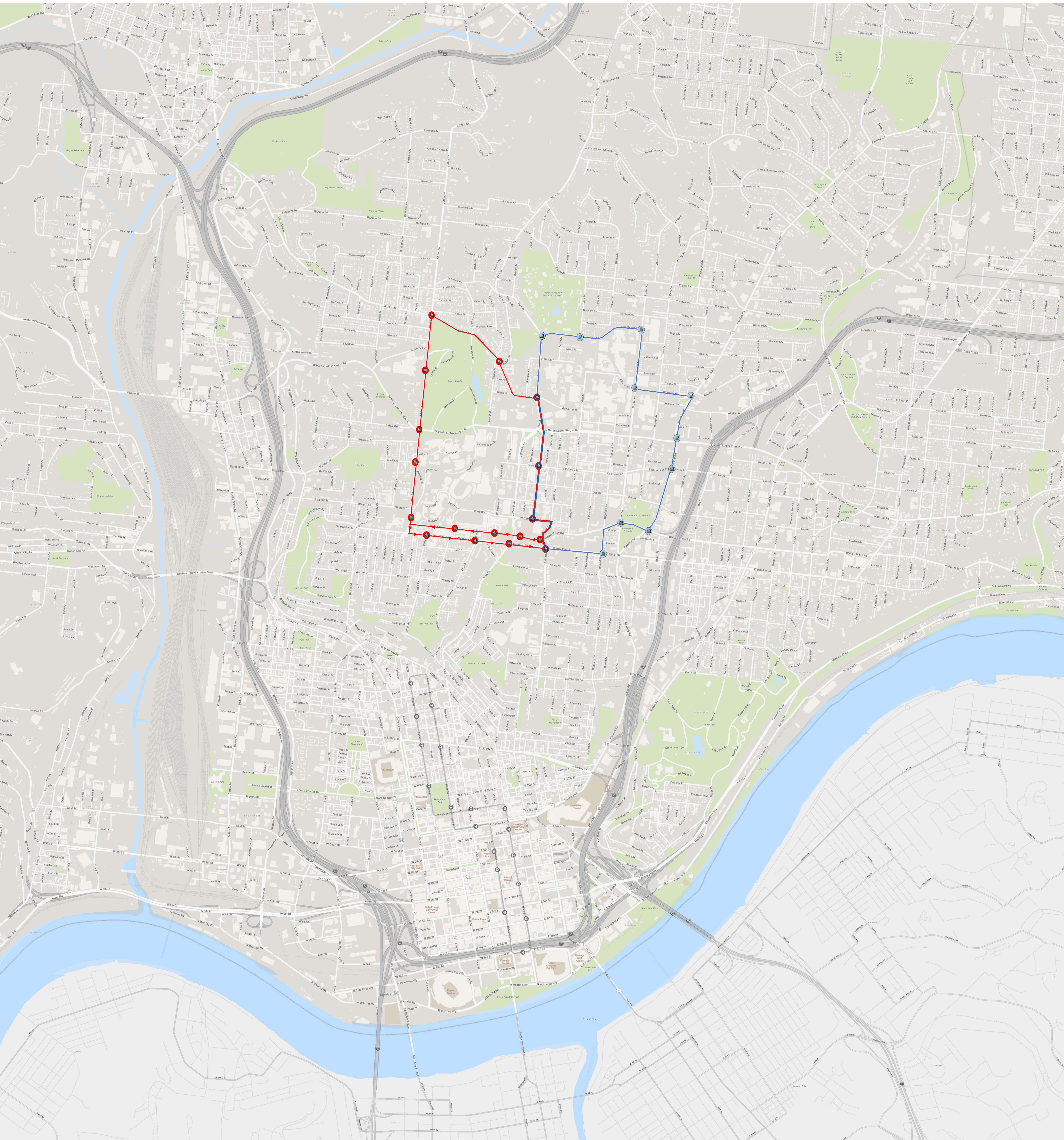
Map Number 4 is similar to Map Number 3 but the red loop does not travel all the way to East Walnut Hills. Instead, it shares track on Gilbert through Walnut Hills with the blue loop, and the loops share track as well along their southern edges on McMillan Street.
Map Number 5 eliminates the eastern portion of the Red Loop along University and Lincoln Avenues and leaves the McMillan Street track to the Blue Loop, forming a smaller circle around the University of Cincinnati for the Red Loop.

Map Number 6 shrinks the blue loop which no longer crosses I-71 to Walnut Hills. It uses Reading Road and Highland Ave. to get to the southern edge of the loop on McMillan Street.
Map Number 7 shrinks the blue loop a final time using Burnett Avenue as its eastern edge, forming a much smaller loop around the hospital campus.

