Description
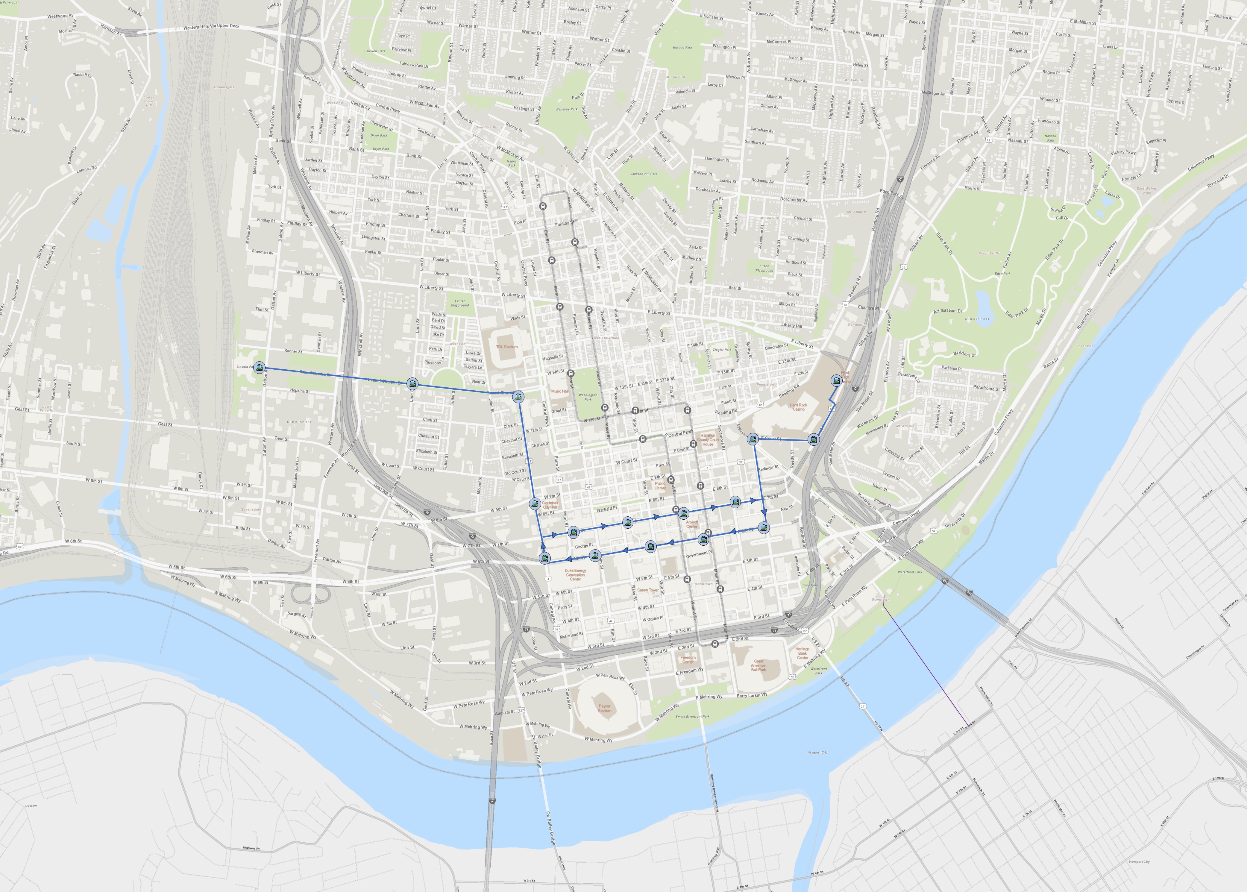
A streetcar track couplet on Sixth and Seventh Streets downtown would show off several of Cincinnati’s great landmarks and streetscapes while providing service to several blocks in need of redevelopment. Extensions to the east and west could connect additional popular destinations to the streetcar system.
| Eastbound Stops | Westbound Stops |
| Union Terminal | Sawyer Point |
| Ezzard Charles and Linn | Reedy and Eggleston |
| Ezzard Charles and Central Ave. | 6th and Broadway |
| 9th and Central Ave. | 6th and Main |
| 7th and Plum | 6th and Vine |
| 7th and Race | 6th and Elm |
| 7th and Walnut | 6th and Central Ave. |
| 7th and Sycamore | 9th and Central Ave. |
| Reedy and Eggleston | Ezzard Charles and Central Ave. |
| Sawyer Point | Ezzard Charles and Linn |
| Union Terminal |
Route Highlights
From iconic Union Terminal, the streetcar proceeds through the West End down Ezzard Charles Drive with a stop serving the West End’s Linn Street business district. It turns south onto Central Avenue passing the Betts Longworth Historic District, the CET building/Town Center Garage potential redevelopment site, and City Hall.
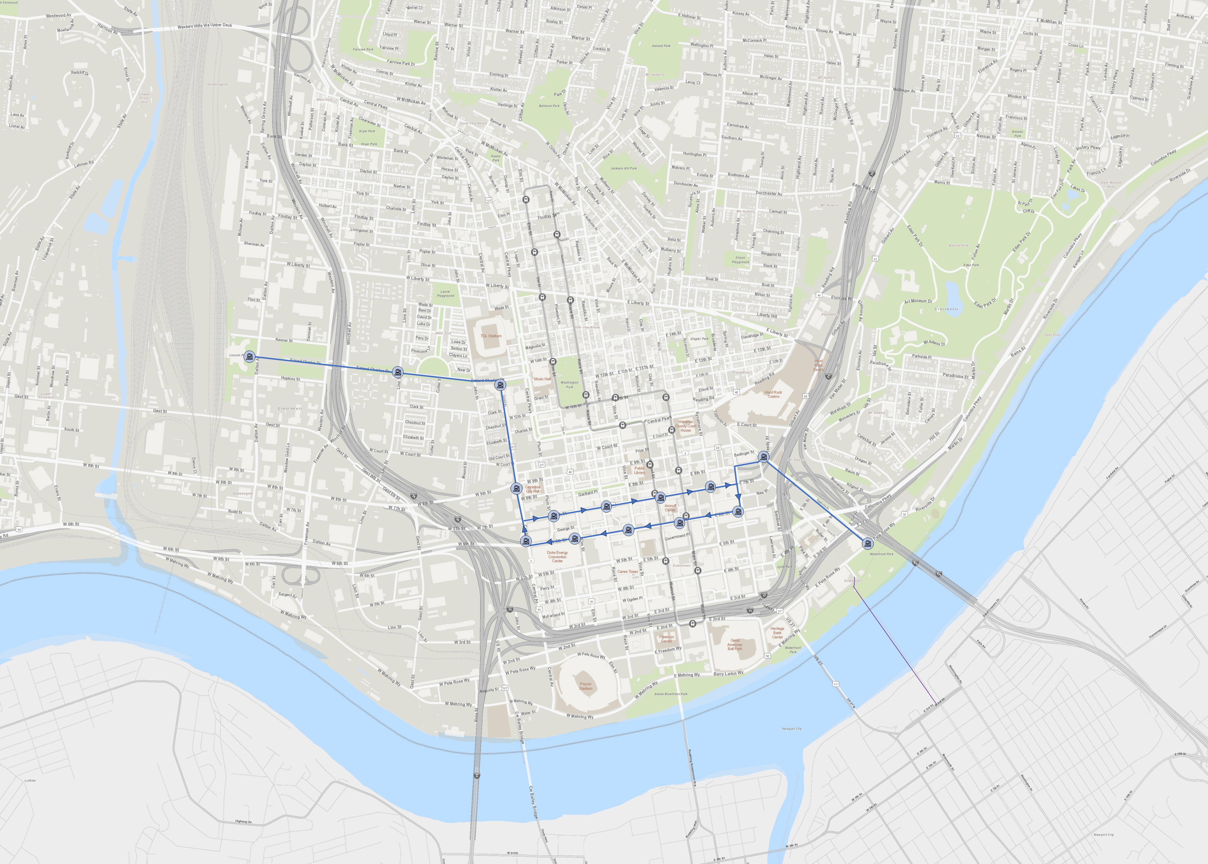
Then, it heads east on Seventh Street with stops evenly spaced every two blocks. There are several landmark historic buildings along the route here or in close proximity, as well as hotels. Several planned and potential redevelopment opportunities are present, such as the Shillito West building, former Macy’s HQ, and multiple surface parking lots. Stop placement provides easy transfer to and from the existing streetcar route.
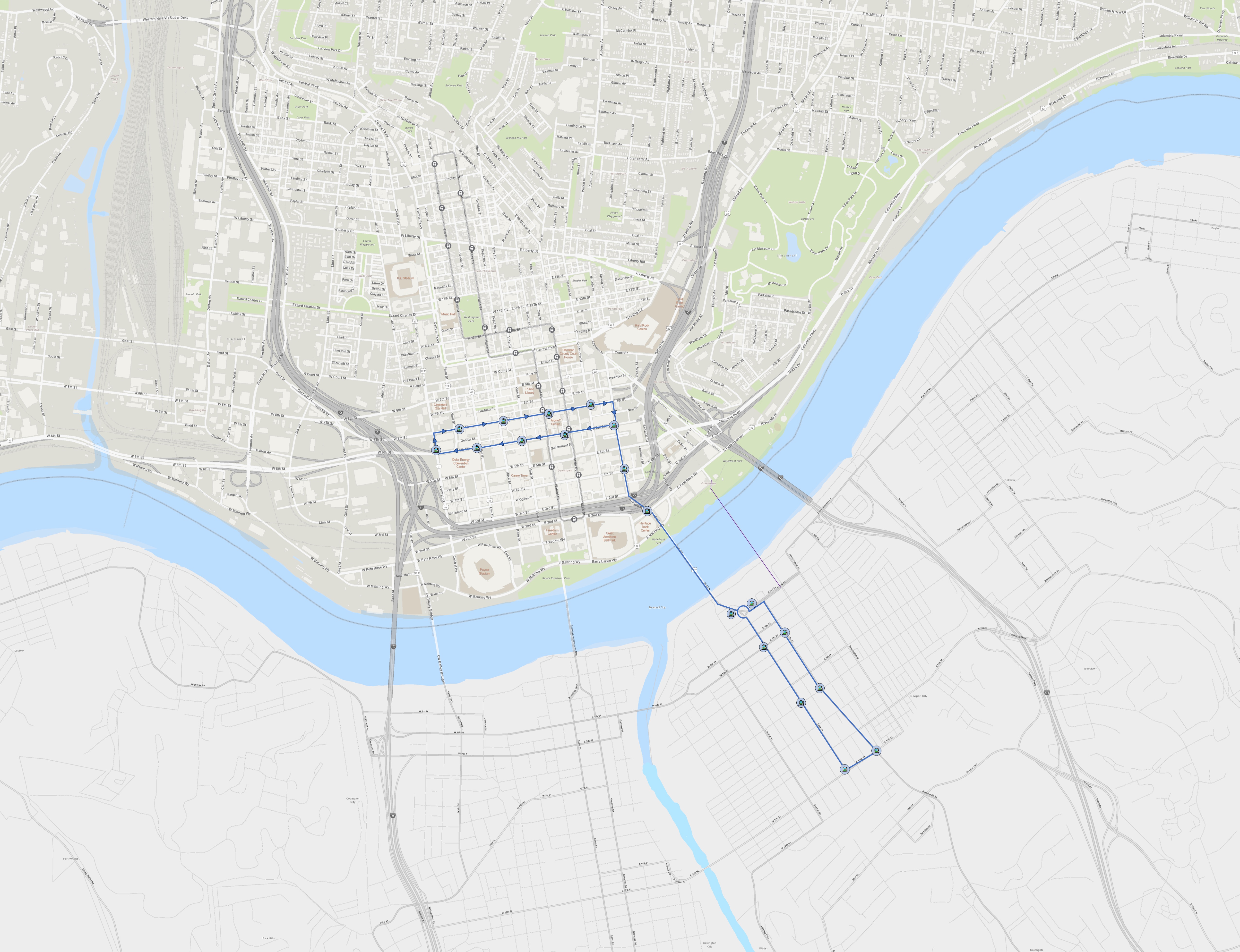
On the eastern end, the route heads north on Broadway and turns right at Reedy St. A stop at Reedy St. provides access to the Casino and potential developments in the surrounding lots. It then heads down Eggleston to Sawyer Point, just a short walk to the Purple People Bridge.
On the return journey it travels west on Sixth Street, passing close by to activity centers such as the Aronoff Center, CAC, and Fountain Square. Still further west, the old Terrace Plaza Hotel presents a redevelopment opportunity. In this area, the route would serve the convention center and could contribute to the building of a new convention center district, where much effort is currently being made. Finally, any new developments on the land freed up by the Bridge Forward concept for the Brent Spence Bridge would be served as well.
The route would then head back to Union Terminal.
Strengths
Like the existing route, this new route shows off some of Cincinnati’s top tier landmarks and tourist attractions.
Strong connections and easy transfer to the existing route.
It could help develop land along the western edge of Downtown now underneath highway interchanges but potentially freed up by the Bridge Forward plan for upcoming Brent Spence Bridge project.
It could serve and help develop major projects now in process like the Convention Center District, old Macy’s HQ, and the Terrace Plaza Hotel.
It could catalyze and serve potential developments on the parking lots along Vine, on the lot at 8th and Sycamore, or on the lot south of the casino.
Connects the convention center district to several possible arena sites as identified by Visit Cincy.
Challenges
Requires Central Avenue to be converted from one way to two way.
Requires Broadway to be converted from one way to two way.
Portions of the route already have access to existing streetcar service, in contrast to a route expands into a new area.
Related Concepts
Works with the concept Streetcar to Queensgate.

Works with the concept Streetcar to Walnut Hills.
Works with the concept Streetcar to Newport.
Alternative Concepts
Tracks could extend eastward on Pete Rose Way from Sawyer Point to International Friendship Park. There, it could connect to some kind of future east side rail.
A stop could be added midway along Eggleston to support development of lots there.
Could redirect the eastern spur to serve an new arena location north of the Casino.