This is a concept for extending the current streetcar route into a light rail-style line that would travel to Cincinnati State, Northside, and the planned Northside Metro transit center.
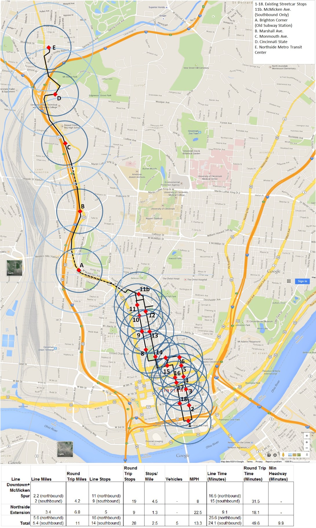
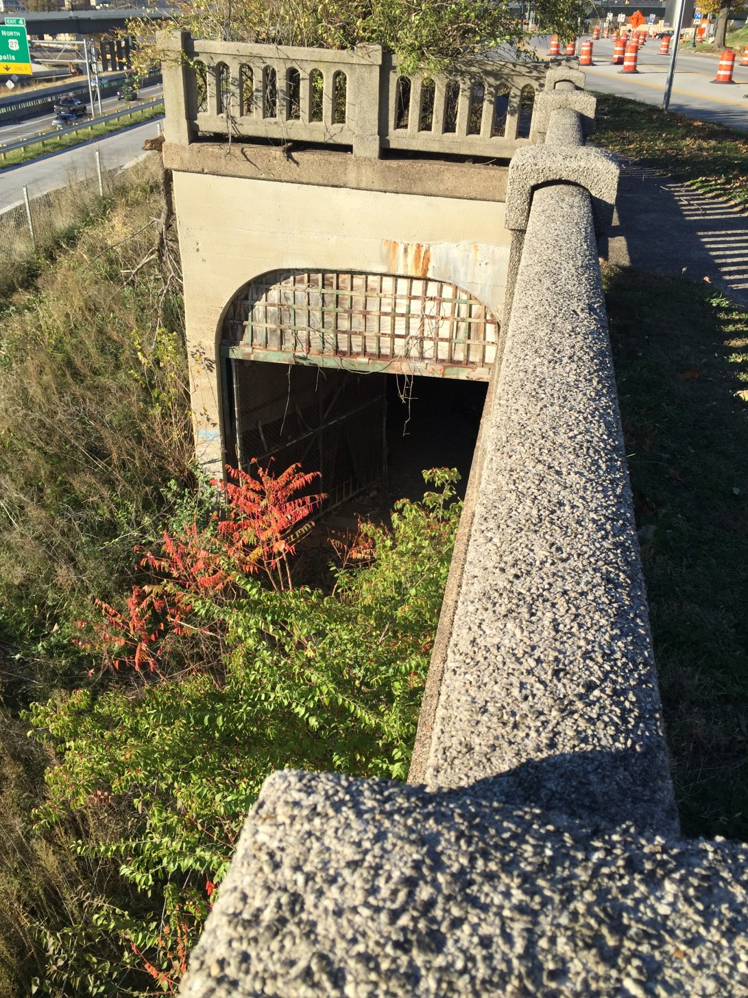
The existing line is extended northward to McMicken Ave. where it cuts over to Stark St. in the area of Hanna Playground. Here, it enters the underground and taps into the old tunnels of the long-abandoned Cincinnati Subway. The old Brighton subway station is used as a stop serving the West End. The line emerges from the tunnels south of Marshall Avenue and travels in a dedicated right of way in between I-75 and Central Parkway. A stop at Marshall serves the southern half of Camp Washington. The track re-enters the old tunnel to pass underneath the Hopple Street interchange. When it re-emerges, a stop at Monmouth Avenue serves northern Camp Washington. The tracks get back on the Parkway for a Cincinnati State stop. Finally, they travel the Ludlow Viaduct into Northside and take a right on Spring Grove Avenue before entering the planned Northside Metro transit center.
Assuming the an average of 22.5 mph after going underground all the way to Northside, and assuming 8 mph in the current streetcar loop, the line would take about 25 minutes from end to end, and be competitive with car travel. With 5 vehicles in operation, the minimum headway would be a about 10 minutes.
This expansion would be adding to the line, according to 2010 Census figures: 2,233 people in Brighton, 1,343 in Camp Washington, and 7,467 from Northside for a total of 11,013. It would adding a big institution, Cincinnati State, and also be connecting to an important transit center outside of downtown. It would also connect neighborhoods with lots of affordable market rate housing stock to an increasingly expensive downtown.
This line could be used to support TOD, Transit Oriented Development. TOD is development where people can live car-free or car- lite and still have access to all their needs via transit. As a result this development can be more cost effective for developers and city tax rolls because it consumes less land for car storage. I envision such development in two places:
- At the Greater Cincinnati Credit Union site, that would be near the Marshall Ave. stop
- At the City Garage site next to the Hopple St. interchange, which would we be in proximity to the Monmouth Ave. stop. In this scenario, the Port Authority could organize a deal to relocate the City Garage facility onto a portion of the old Kahn’s industrial site (assuming the garage needs to stay close to the Camp Washington salt pile.) Then the Port Authority could take over the present City Garage site where it would have more options to build mixed use development including residential, office and/or hotel that would be served by rail transit.
The Port Authority could also partner with Cincinnati State to include space for additional new Cincinnati State facilities at the Port Authority-developed City Garage site (or at another stop along the streetcar line.) Part of the rationale for the proposed Cincinnati State-South Cumminsville road bridge connector is providing room for the expansion of Cincinnati State. What if instead this expansion was a short ride down the Parkway on frequent transit? The roughly $40 million cost of the bridge could be avoided entirely, the facilities would be roughly the same distance away, and served by transit.
Old tunnels underneath Hopple:
The City Garage site: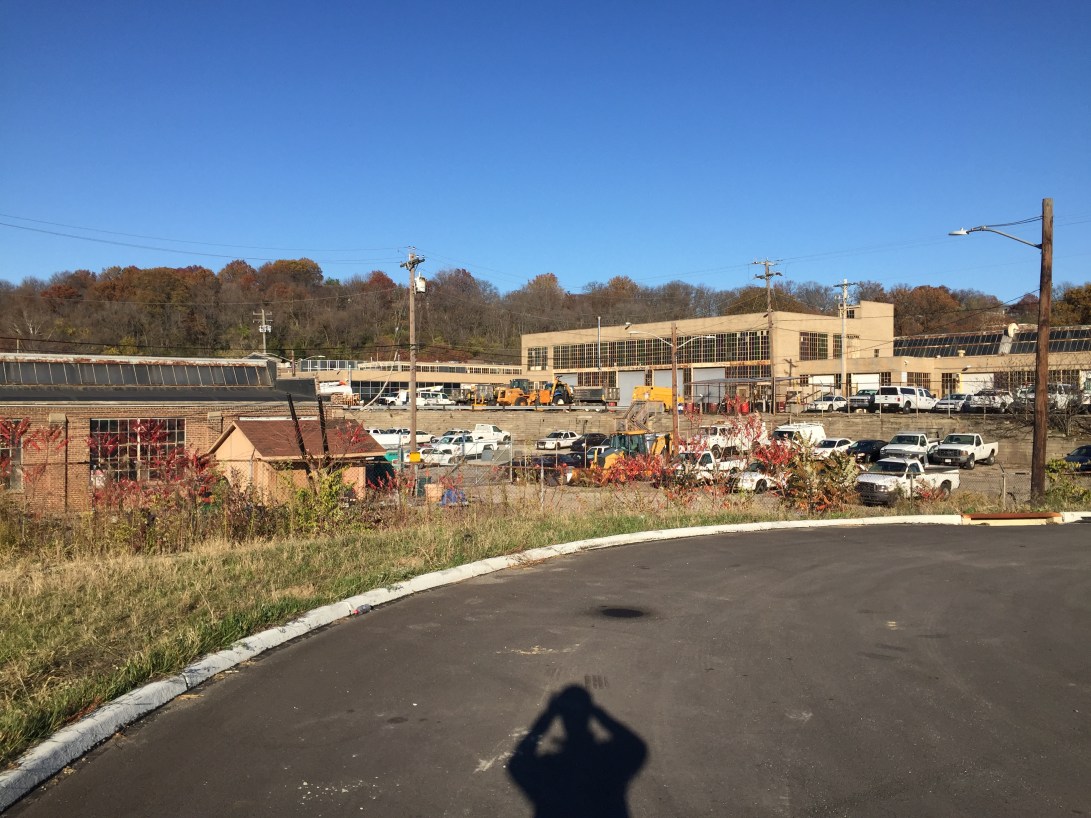
This concept could be paired with a light rail-style line to Uptown for the beginnings of a regional light rail system.
(Thanks to Jake Mecklenborg and Travis Estell for inspiration on this idea)
